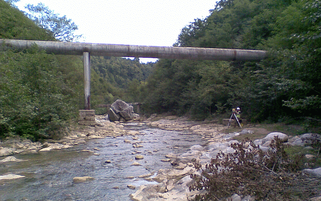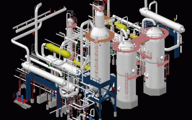
We have developed a method of 'mapping' pipelines from the surface without the use of an IMU (Inertial Measurement Unit).
Read more
We can provide or source lidar surveys for you based on an independent appraisal of your requirements. We also provide independent quality control, confirming the accuracy of LiDAR data sets.
Read more
Based in England we have expanded to work throughout the world in over 50 countries.
Read more
We provide pipeline mapping surveys worldwide, from airborne and terrestrial laser scanning to GPS asset surveys. We can map pipelines without an IMU, having merged your MFL data to provide accurate co-ordinates of every anomaly and defect, we can then stake out those defects for you - saving time and cost on repair and investigative digs and excavations.
From terrestrial and airborne laser scanners to UAV drones, we use the latest and most efficient technology.

From the deserts of Algeria and Oman to snow covered Greenland, we can survey in all conditions.
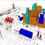
DTM models, contours & difference maps, Merrett Survey have provided quality products to clients for over 25 years.


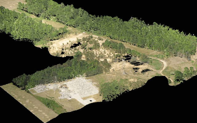
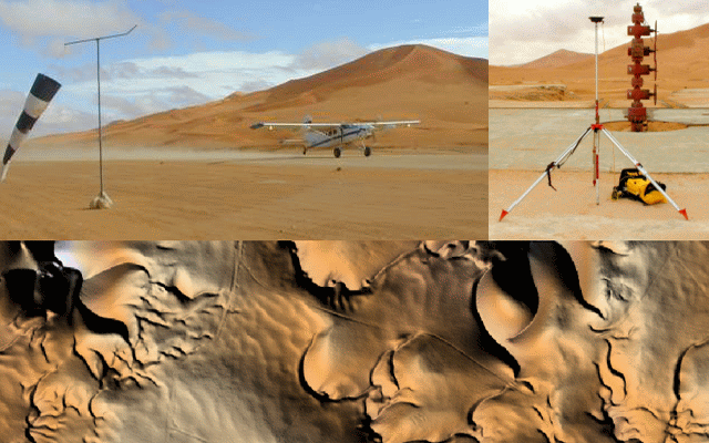
LiDAR can aid in the evaluation of prospective sites, a LiDAR survey can include aerial photography and provide digital elevation models, contours, slope and aspect maps that can be incorporated into a GIS package,
LiDAR has the advantage of 'seeing through the foliage' to map the ground even in rainforest. A LiDAR survey can aid in pre-planning, identify staging areas, position construction crews to work in downhill directions, logistic planning and safety planning.
For a large project in Algeria we assisted the client with a LiDAR survey for a seismic project where we delivered seismic line profiles that were used to determine elevation changes and slope.
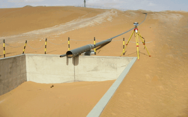
Merrett Surveys have wide ranging experience of topographic surveys for new pipeline routes and diversions. This includes river crossings, rainforest, temperate and desert climates.
In preparing a preliminary route map, survey data needs to be gathered in order to produce construction alignment sheets, permit drawings, easement plats and engineering detail design drawings. An as-built survey should be carried out during construction of the pipeline so that the exact location of the pipe can be recorded and the data used to prepare the final as-built drawings.
Merrett Surveys professional surveyors have vast experience in pipeline surveys and use the latest technology, including EDM total stations, double depth pipeline detection equipment, GPS and terrestrial laser scanning. Our experienced surveyors gather survey information and record attributes such that they can be used in any CAD and GIS programs.
We provide:
PipelineMapping.com is a specialised part of Merrett Survey Limited's worldwide survey services. The company started trading in 1982, so in August 2012 Merrett Survey celebrated 30 years of topographical survey business. Based in the South West of England we have expanded to work throughout the world in over 50 countries including Australia, New Zealand, Algeria, France, Guinea, Bermuda, Philippines and the USA to name but a few.
Merrett Survey was one of the first commercial organisations to invest in GPS technology so we have built up a mass of experience and knowledge. More recently we have been applying the latest surveying technologies including airborne and land based laser scanning ( LIDAR ).
It is the aim of Merrett Survey to meet the needs of our clients by
providing a high quality and cost effective service. We will advise and
put forward innovative ideas and new technology to benefit all parties
by working in Partnership.
Merretts put forward innovative ideas and use new technology. We offer a wide range of survey services.
Our client list includes:-
World Bank / Asian Development Bank
Environment Agency (UK)
Ordnance Survey (UK's National Mapping Agency)
IGN ( France's National Mapping Agency )
DPWH (Department of Public Works and Highways, Philippines)
UN (United Nations)
""Their deep understanding of GPS & rigid quality controls has particularly impressed us""
""Merretts have shown themselves to be technically very capable, providing a positive professional approach""
"Merretts provided an excellent service when called upon. They were responsive, helpful, innovative and effective and worked well as part of the overall team delivering emergency response to the South West of England."







3, Merlin Business Park, Fairoak Close,
Exeter Airport, EX5 2UL, UK
For UK and 'rest of the world' use-
Telephone +44 (0) 1392 362161
Fax +44 (0) 1392 362289
info@pipelinemapping.com
3, Merlin Business Park, Fairoak Close, Exeter Airport, EX5 2UL, UK
info@pipelinemapping.com+44 (0) 1392 362161